Archaeological Site of Italica (Santiponce)
Archaeological Site of Italica
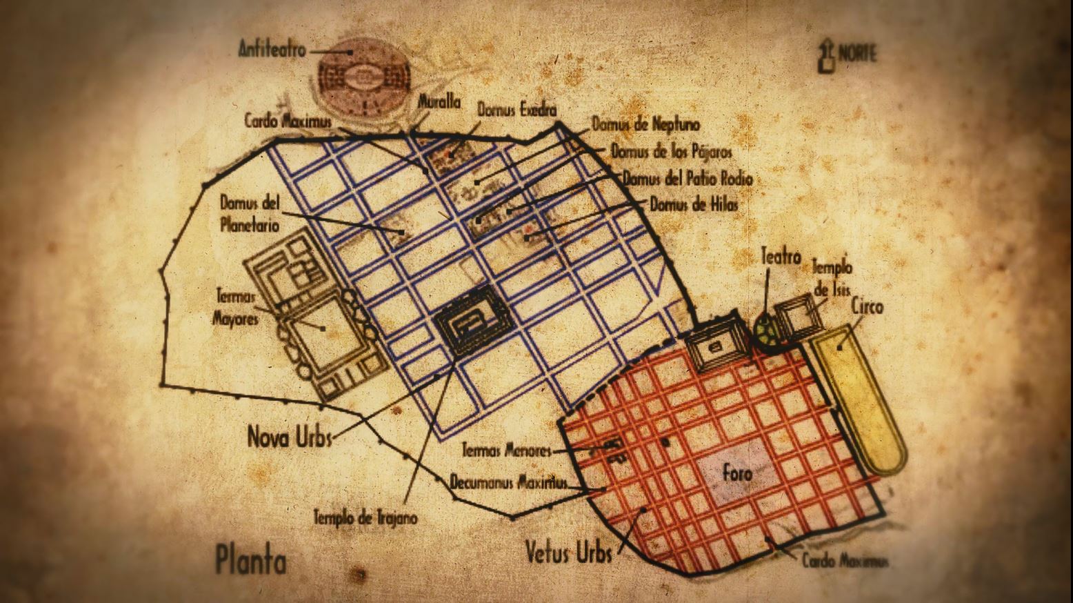
The Roman city of Italica, located in the Lower Guadalquivir, halfway between Seville (Hispalis) and Alcala del Rio (Ilipa) and very close to the routes that connected with the mining area of the Sierra Norte de Sevilla and Huelva, played an important strategic role both politico-military and economic during the High Roman Empire, proof of this is that it came to occupy an area of approximately 52 hectares.
Its origins date back to 206 B.C., when the general Publius Cornelius Scipio, in the context of the second Punic War, defeated the Carthaginians in the battle of Ilipa and established a detachment of legionaries in the Cerro de San Antonio, where there was already a Turdetan population since the fourth century B.C. Although at first both communities coexisted in this area near the Guadalquivir, soon the Roman element imposed its social and political ways. In the second half of the first century B.C. the city acquired municipal status and, after some time, during the rule of the emperor Hadrian (117-138 A.D.), that of colony, thus becoming administratively equal to the metropolis.
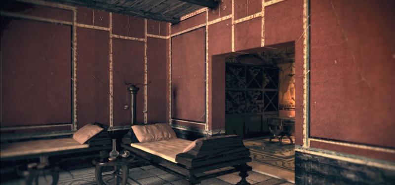
The Andalusian Government, through the Ministry of Culture and Historical Heritage and the Ministry of Economic Transformation, has launched the application Espacios Junta for mobile devices that allows visitors to the Archaeological Site to access both virtual and augmented reality content and 3D recreations of the amphitheater and the House of the Birds, two of the most emblematic areas of the Roman city located in the Sevillian municipality of Santiponce.
This APP is now available for free download at this link.